Recent Earthquakes in California and Nevada
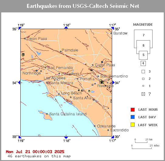
Click on an earthquake on the above map for more information.
Click on an arrow at edge or corner of above map to go to an adjacent map.
Update time = Tue Jul 7 05:00:02 2026
Here are the earthquakes appearing on this map, most recent at top ...
| MAG | LOCAL DATETIME y/m/d h:m:s |
LAT deg |
LON deg |
DEPTH km |
LOCATION |
| 1.4 | 2026/07/07 04:10:20 | 33.868N | 117.536W | 4.37 | 2 km ( 1 mi) SW of Home Gardens, CA |
| 0.6 | 2026/07/07 00:00:31 | 34.037N | 117.181W | 9.91 | 2 km ( 1 mi) S of Redlands, CA |
| 1.0 | 2026/07/06 23:42:15 | 34.072N | 117.273W | 16.65 | 3 km ( 2 mi) NNW of Loma Linda, CA |
| 1.0 | 2026/07/06 23:05:01 | 34.512N | 118.126W | 13.52 | 2 km ( 1 mi) NW of Vincent, CA |
| 1.6 | 2026/07/06 16:42:16 | 34.380N | 118.834W | 22.16 | 5 km ( 3 mi) SW of Piru, CA |
| 2.2 | 2026/07/06 15:23:21 | 33.361N | 118.335W | 19.67 | 2 km ( 1 mi) NNW of Avalon, CA |
| 1.5 | 2026/07/06 14:59:22 | 33.844N | 117.493W | 2.37 | 5 km ( 3 mi) SE of Home Gardens, CA |
| 1.2 | 2026/07/06 11:57:17 | 34.987N | 118.193W | 0.61 | 7 km ( 5 mi) SSW of Mojave, CA |
| 1.0 | 2026/07/06 10:44:38 | 34.012N | 117.209W | 5.18 | 5 km ( 3 mi) SSW of Redlands, CA |
| 3.2 | 2026/07/06 05:48:02 | 33.452N | 118.275W | 8.82 | 13 km ( 8 mi) NNE of Avalon, CA |
| 1.1 | 2026/07/06 05:43:39 | 34.025N | 117.227W | 14.71 | 4 km ( 3 mi) SE of Loma Linda, CA |
| 0.7 | 2026/07/06 04:04:44 | 34.016N | 117.192W | 3.72 | 4 km ( 3 mi) S of Redlands, CA |
| 0.7 | 2026/07/06 03:02:35 | 34.020N | 117.193W | 4.86 | 4 km ( 3 mi) SSW of Redlands, CA |
| 1.2 | 2026/07/06 01:32:07 | 34.374N | 117.651W | 8.48 | 2 km ( 1 mi) NW of Wrightwood, CA |
| 1.3 | 2026/07/05 17:10:40 | 34.153N | 118.522W | 9.74 | 2 km ( 1 mi) WSW of Encino, CA |
| 1.8 | 2026/07/05 10:49:11 | 33.956N | 118.482W | 11.03 | 4 km ( 2 mi) SW of Marina del Rey, CA |
| 0.5 | 2026/07/05 06:28:16 | 33.902N | 117.321W | 7.40 | 4 km ( 2 mi) ENE of Woodcrest, CA |
| 1.4 | 2026/07/05 02:55:58 | 33.383N | 117.612W | 14.27 | 5 km ( 3 mi) S of San Clemente, CA |
| 0.6 | 2026/07/05 00:55:35 | 34.263N | 117.086W | 8.80 | 6 km ( 4 mi) NNE of Running Springs, CA |
| 0.4 | 2026/07/04 22:56:04 | 34.200N | 117.069W | 2.47 | 4 km ( 2 mi) ESE of Running Springs, CA |
| 0.0 | 2026/07/04 21:48:16 | 34.060N | 117.992W | 0.00 | 2 km ( 1 mi) WNW of West Puente Valley, CA |
| 0.0 | 2026/07/04 21:19:09 | 34.029N | 117.644W | 0.00 | 3 km ( 2 mi) SSW of Ontario, CA |
| 0.0 | 2026/07/04 21:17:47 | 33.913N | 117.482W | 0.00 | 5 km ( 3 mi) NE of Home Gardens, CA |
| 0.0 | 2026/07/04 21:15:36 | 33.737N | 117.579W | 0.00 | 8 km ( 5 mi) N of Trabuco Canyon, CA |
| 0.0 | 2026/07/04 21:14:10 | 33.569N | 117.634W | 0.00 | 0 km ( 0 mi) SE of Ladera Ranch, CA |
| 0.0 | 2026/07/04 21:11:55 | 33.822N | 117.423W | 0.00 | 9 km ( 6 mi) SW of Woodcrest, CA |
| 0.0 | 2026/07/04 21:11:32 | 34.127N | 117.865W | 0.00 | 1 km ( 1 mi) S of Glendora, CA |
| 0.0 | 2026/07/04 21:09:05 | 33.982N | 117.515W | 0.00 | 1 km ( 1 mi) S of Mira Loma, CA |
| 0.0 | 2026/07/04 21:05:47 | 34.214N | 117.124W | 0.00 | 1 km ( 1 mi) WNW of Running Springs, CA |
| 0.0 | 2026/07/04 21:03:40 | 33.898N | 117.721W | 0.00 | 9 km ( 5 mi) E of Yorba Linda, CA |
| 0.0 | 2026/07/04 20:57:38 | 33.963N | 117.613W | 0.00 | 7 km ( 4 mi) WNW of Norco, CA |
| 1.0 | 2026/07/04 18:46:32 | 34.008N | 117.207W | 15.89 | 6 km ( 4 mi) SSW of Redlands, CA |
| 1.2 | 2026/07/04 12:10:04 | 34.584N | 118.883W | 2.35 | 20 km (13 mi) NNW of Piru, CA |
| 0.9 | 2026/07/04 10:53:32 | 34.213N | 117.078W | 4.00 | 3 km ( 2 mi) ENE of Running Springs, CA |
| 1.8 | 2026/07/04 09:03:42 | 34.585N | 118.882W | 2.19 | 21 km (13 mi) NNW of Piru, CA |
| 0.8 | 2026/07/04 04:27:21 | 34.406N | 118.565W | 4.74 | 5 km ( 3 mi) S of Valencia, CA |
| 1.4 | 2026/07/04 04:07:19 | 34.585N | 118.883W | 2.03 | 21 km (13 mi) NNW of Piru, CA |
| 0.5 | 2026/07/04 02:46:10 | 33.983N | 117.154W | 11.39 | 8 km ( 5 mi) SSE of Redlands, CA |
| 1.1 | 2026/07/04 01:26:47 | 34.580N | 118.886W | 4.57 | 20 km (13 mi) NNW of Piru, CA |
| 1.9 | 2026/07/04 00:52:35 | 34.589N | 118.882W | 1.70 | 21 km (13 mi) NNW of Piru, CA |
| 0.8 | 2026/07/03 23:09:44 | 34.255N | 117.236W | 21.15 | 4 km ( 3 mi) W of Lake Arrowhead, CA |
| 0.6 | 2026/07/03 20:30:06 | 34.001N | 117.219W | 4.59 | 6 km ( 4 mi) SE of Loma Linda, CA |
| 1.4 | 2026/07/03 19:30:12 | 33.814N | 117.668W | 4.12 | 11 km ( 7 mi) SW of Corona, CA |
| 1.0 | 2026/07/03 16:44:57 | 34.196N | 117.438W | 9.81 | 4 km ( 3 mi) SW of Devore, CA |
| 0.1 | 2026/07/03 15:34:38 | 34.217N | 117.096W | 7.83 | 2 km ( 1 mi) NE of Running Springs, CA |
| 1.4 | 2026/07/03 15:07:02 | 34.507N | 118.830W | 2.59 | 11 km ( 7 mi) NNW of Piru, CA |
| 1.2 | 2026/07/03 11:01:10 | 34.213N | 117.078W | 3.81 | 3 km ( 2 mi) E of Running Springs, CA |
| 0.9 | 2026/07/03 10:34:45 | 34.215N | 117.076W | 3.64 | 3 km ( 2 mi) ENE of Running Springs, CA |
| 2.0 | 2026/07/03 10:31:02 | 34.215N | 117.076W | 3.70 | 3 km ( 2 mi) ENE of Running Springs, CA |
| 1.1 | 2026/07/03 10:30:21 | 34.216N | 117.075W | 3.77 | 3 km ( 2 mi) ENE of Running Springs, CA |
| 0.9 | 2026/07/03 09:58:43 | 34.019N | 117.211W | 7.93 | 5 km ( 3 mi) SSW of Redlands, CA |
| 1.2 | 2026/07/03 09:54:20 | 34.639N | 117.306W | -0.69 | 11 km ( 7 mi) NE of Adelanto, CA |
| 1.5 | 2026/07/03 08:07:24 | 34.215N | 117.077W | 3.57 | 3 km ( 2 mi) ENE of Running Springs, CA |
| 0.8 | 2026/07/03 07:35:55 | 34.031N | 117.204W | 12.34 | 3 km ( 2 mi) SW of Redlands, CA |
| 1.4 | 2026/07/03 07:30:18 | 34.142N | 118.365W | 16.21 | 1 km ( 1 mi) WNW of Universal City, CA |
| 1.1 | 2026/07/03 06:43:19 | 34.581N | 118.886W | 2.20 | 20 km (13 mi) NNW of Piru, CA |
| 1.4 | 2026/07/03 06:38:39 | 34.583N | 118.887W | 2.08 | 20 km (13 mi) NNW of Piru, CA |
| 0.7 | 2026/07/03 04:18:47 | 33.807N | 117.633W | 9.86 | 9 km ( 6 mi) SW of Corona, CA |
| 1.8 | 2026/07/02 23:53:54 | 34.586N | 118.883W | 2.32 | 21 km (13 mi) NNW of Piru, CA |
| 0.9 | 2026/07/02 20:48:33 | 34.955N | 118.481W | 2.31 | 20 km (12 mi) S of Tehachapi, CA |
| 1.3 | 2026/07/02 20:40:50 | 34.589N | 118.889W | 1.49 | 21 km (13 mi) NNW of Piru, CA |
| 1.4 | 2026/07/02 20:02:11 | 34.583N | 118.885W | 2.02 | 20 km (13 mi) NNW of Piru, CA |
| 1.0 | 2026/07/02 15:20:03 | 34.039N | 117.244W | 16.13 | 2 km ( 1 mi) SE of Loma Linda, CA |
| 1.4 | 2026/07/02 11:57:36 | 34.986N | 118.188W | -0.82 | 3 km ( 2 mi) SSW of Quarry at TPO-DBM (Probable quarry explosion) |
| 1.7 | 2026/07/02 11:37:20 | 33.849N | 117.493W | -0.50 | 1 km ( 0 mi) E of Quarry at CORONA (Probable quarry explosion) |
| 1.5 | 2026/07/02 11:07:10 | 33.820N | 117.487W | -0.64 | 4 km ( 2 mi) SSE of Quarry at CORONA (Probable quarry explosion) |
| 1.4 | 2026/07/02 10:00:04 | 34.022N | 117.590W | 5.05 | 5 km ( 3 mi) SE of Ontario, CA |
| 1.5 | 2026/07/02 07:14:19 | 33.587N | 117.895W | 13.26 | 5 km ( 3 mi) SE of Newport Beach, CA |
| 1.0 | 2026/07/02 06:29:31 | 34.120N | 117.598W | 11.03 | 2 km ( 1 mi) W of Rancho Cucamonga, CA |
| 1.4 | 2026/07/01 15:16:27 | 33.713N | 117.333W | -0.53 | 21 km (13 mi) NE of Quarry at ELS (Probable quarry explosion) |
| 0.9 | 2026/07/01 12:47:46 | 33.843N | 117.770W | 6.98 | 5 km ( 3 mi) NE of Villa Park, CA |
| 1.3 | 2026/07/01 12:29:21 | 34.181N | 117.924W | -0.91 | 22 km (14 mi) NNW of Quarry at POMONA (Probable quarry explosion) |
| 1.0 | 2026/07/01 10:28:22 | 34.957N | 118.602W | 8.57 | 20 km (12 mi) N of Neenach, CA |
| 1.1 | 2026/07/01 09:27:52 | 34.022N | 117.204W | 13.13 | 4 km ( 3 mi) SSW of Redlands, CA |
| 2.0 | 2026/07/01 08:59:59 | 34.830N | 118.913W | 10.19 | 3 km ( 2 mi) ENE of Frazier Park, CA |
| 0.7 | 2026/07/01 06:59:33 | 33.660N | 117.012W | 10.04 | 9 km ( 5 mi) SE of Winchester, CA |
| 0.8 | 2026/06/30 23:41:31 | 34.215N | 117.078W | 3.67 | 3 km ( 2 mi) ENE of Running Springs, CA |
| 0.5 | 2026/06/30 23:13:46 | 34.114N | 117.477W | 6.65 | 2 km ( 2 mi) NW of Fontana, CA |
| 1.2 | 2026/06/30 19:34:18 | 34.407N | 118.617W | 6.17 | 7 km ( 4 mi) SW of Valencia, CA |
| 1.3 | 2026/06/30 12:00:57 | 34.980N | 118.175W | -0.82 | 3 km ( 2 mi) S of Quarry at TPO-DBM (Probable quarry explosion) |
| 0.9 | 2026/06/30 11:35:22 | 34.214N | 117.077W | 3.73 | 3 km ( 2 mi) ENE of Running Springs, CA |
[
Index map ||
Big earthquake list ||
All earthquake list ||
Glossary of terms ||
Top page
]
[
Did you feel it? ||
ShakeMaps
|| Relative2Me
]
[ Data Sources ]
Special maps
Long Valley || Los Angeles || San Francisco
Data Sources
US and World - USGS/NEIC = National Earthquake Information Center
Northern California - UCB = University of California, Berkeley
Southern California - Caltech = California Institute of Technology
Nevada - UNR = University of Nevada, Reno
Offshore = West Coast & Alaska Tsunami Warning Center
...all members of the Advanced National Seismic System (ANSS)