Earthquake Information
Chronological Earthquake Index
Landers Earthquake
TYPE OF FAULTING: right-lateral strike-slip
TIME: June 28, 1992 / 4:57:31 am PDT
LOCATION: 34° 13' N, 116° 26' W 6 miles north of Yucca Valley
MAGNITUDE: MW7.3
RUPTURE LENGTH: 85 km (53 miles)
FAULTS RUPTURED: Johnson Valley, Landers, Homestead Valley, Emerson, and Camp Rock; several other faults experienced minor rupture, rupture during large aftershocks, or triggered slip
AVERAGE SLIP: about 3 to 4 meters; maximum slip of 6 meters
DEPTH: 1.1 km
LARGEST AFTERSHOCK: Big Bear earthquake, MS 6.4
View rupture movie 
(Click thumbnails for more information)
At magnitude 7.3, the Landers earthquake was the largest earthquake to hit Southern California in 40 years. Centered in the Mojave Desert, approximately 120 miles from Los Angeles, the earthquake caused relatively little damage for its size.
The power of the earthquake was illustrated by the length of the ground rupture it left behind. The earthquake ruptured 5 separate faults: Johnson Valley, Landers, Homestead Valley, Emerson, and Camp Rock faults. The total rupture length was ~85km (53 miles), and the faults slipped from 2 meters (~6 ft) to a maximum of 6 meters (~18 ft). Nearby faults also experienced triggered slip and minor surface rupture.
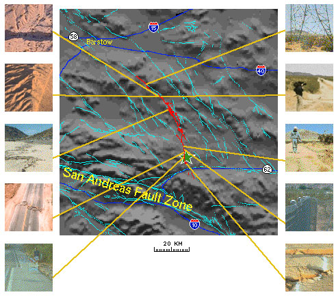
This map shows the topography and some major landmarks of the area around the Landers epicenter, which is shown as a green star with a white outline. The surface rupture caused by the earthquake is shown in red. Major highways are labelled and shown in blue.
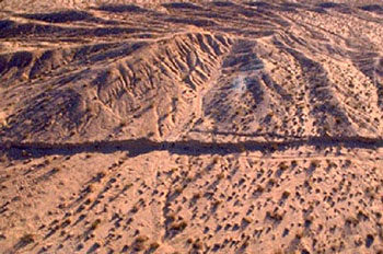
Landers Surface Rupture
A view of the surface rupture caused by the Landers quake,
in some of the wide-open areas of the Mojave Desert.
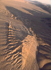
Landers Surface Rupture
Another view of the surface rupture caused by the Landers quake, in some of the wide-open areas of the Mojave Desert. (photo: Ta-Liang Teng)
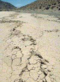
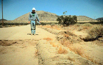
Landers Surface Rupture
This dry lake bed, or playa, in the Mojave Desert was torn by the surface rupture of the Landers earthquake. (photo: Helen Qian)
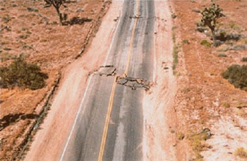
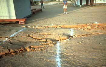
Damage to Highway 274
The surface rupture of the Landers earthquake tore across the
pavement of Highway 247, showing strike-slip offset quite dramatically.
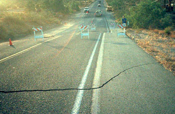
Damage to Highway 274
Surface rupture produced left and right offsets in the asphalt of
Highway 247, about one-half mile south of Reche Road
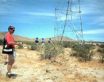
Landers Earthquake Damage
A view of a tower -- one that stood directly atop the surface rupture
of the Landers earthquake, and was consequently sheared and twisted
by the sudden horizontal offset. Remarkably, the tower did not collapse
despite the damage it sustained.
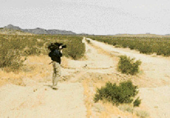
Landers Surface Rupture
Several meters of offset can be seen at the place where the
Landers rupture crossed this dirt road, one of many similar
sights along the rupture path.
Landers Surface Rupture
Obvious right-lateral offset with a noticeable vertical component
is shown by this berm on the side of Garrison Lane.
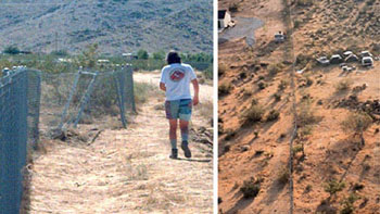
Chain-link fences in the Landers area served as excellent
markers, not only of the location of surface rupture, but
also its extent. (photo: Helen Qian)
Parking spaces at the Country Gospel Church near
Highway 247 and Eureka Road in Landers were quite
noticeably offset by the surface rupture.