Recent Earthquakes in California and Nevada
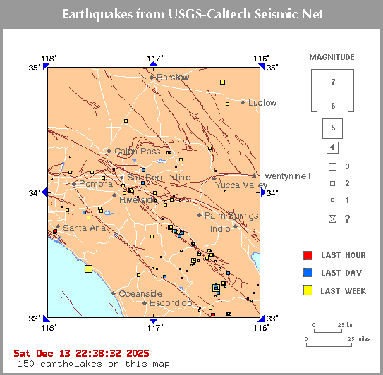
Click on an earthquake on the above map for more information.
Click on an arrow at edge or corner of above map to go to an adjacent map.
Update time = Thu Jul 30 11:00:03 2026
Here are the earthquakes appearing on this map, most recent at top ...
| MAG | LOCAL DATETIME y/m/d h:m:s |
LAT deg |
LON deg |
DEPTH km |
LOCATION |
| 1.2 | 2026/07/30 10:50:44 | 33.316N | 116.314W | 12.02 | 9 km ( 5 mi) NE of Borrego Springs, CA |
| 1.0 | 2026/07/30 07:36:46 | 33.319N | 116.316W | 12.31 | 9 km ( 6 mi) NE of Borrego Springs, CA |
| 0.7 | 2026/07/30 06:30:53 | 33.858N | 116.804W | 17.22 | 7 km ( 4 mi) SSW of Cabazon, CA |
| 1.0 | 2026/07/30 06:28:06 | 33.139N | 116.017W | 4.98 | 11 km ( 7 mi) E of Ocotillo Wells, CA |
| 1.4 | 2026/07/30 06:14:04 | 33.841N | 116.921W | 14.60 | 7 km ( 5 mi) NNE of San Jacinto, CA |
| 1.0 | 2026/07/30 04:05:54 | 33.150N | 116.080W | 10.43 | 5 km ( 3 mi) E of Ocotillo Wells, CA |
| 1.0 | 2026/07/30 03:35:00 | 33.701N | 117.433W | 9.05 | 10 km ( 6 mi) WNW of Lake Elsinore, CA |
| 0.6 | 2026/07/30 00:06:07 | 33.458N | 116.413W | 11.59 | 23 km (14 mi) N of Borrego Springs, CA |
| 0.8 | 2026/07/29 23:59:10 | 34.039N | 116.783W | 13.36 | 14 km ( 8 mi) N of Cabazon, CA |
| 0.8 | 2026/07/29 23:56:11 | 33.320N | 116.188W | 11.35 | 18 km (11 mi) SSW of Oasis, CA |
| 0.6 | 2026/07/29 23:56:05 | 33.461N | 116.546W | 10.71 | 16 km (10 mi) SE of Anza, CA |
| 0.6 | 2026/07/29 23:55:21 | 33.477N | 116.496W | 12.72 | 19 km (12 mi) ESE of Anza, CA |
| 0.9 | 2026/07/29 22:55:42 | 33.346N | 116.344W | 11.24 | 10 km ( 6 mi) NNE of Borrego Springs, CA |
| 1.2 | 2026/07/29 21:13:55 | 34.078N | 117.281W | 15.94 | 3 km ( 2 mi) E of Colton, CA |
| 1.1 | 2026/07/29 21:08:20 | 33.315N | 116.189W | 10.79 | 18 km (11 mi) ENE of Borrego Springs, CA |
| 1.3 | 2026/07/29 20:00:33 | 33.014N | 116.251W | 4.98 | 18 km (11 mi) SW of Ocotillo Wells, CA |
| 1.3 | 2026/07/29 19:44:53 | 33.032N | 116.291W | 6.01 | 19 km (12 mi) SW of Ocotillo Wells, CA |
| 0.7 | 2026/07/29 19:44:06 | 33.529N | 116.739W | 4.27 | 7 km ( 4 mi) WSW of Anza, CA |
| 1.0 | 2026/07/29 18:30:12 | 33.455N | 116.421W | 11.11 | 23 km (14 mi) N of Borrego Springs, CA |
| 1.4 | 2026/07/29 15:28:51 | 34.639N | 117.305W | -0.81 | 2 km ( 1 mi) NNW of Quarry at ORO-GRANDE (Probable quarry explosion) |
| 0.4 | 2026/07/29 15:17:27 | 33.373N | 116.689W | 12.29 | 11 km ( 7 mi) NNW of Warner Springs, CA |
| 0.6 | 2026/07/29 15:14:44 | 33.477N | 116.507W | 14.50 | 18 km (11 mi) ESE of Anza, CA |
| 0.6 | 2026/07/29 15:14:41 | 33.481N | 116.515W | 12.99 | 17 km (10 mi) ESE of Anza, CA |
| 1.5 | 2026/07/29 14:00:59 | 33.986N | 116.979W | 17.33 | 6 km ( 4 mi) N of Beaumont, CA |
| 1.2 | 2026/07/29 14:00:53 | 34.335N | 116.823W | 7.40 | 8 km ( 5 mi) NNE of Big Bear City, CA |
| 1.2 | 2026/07/29 13:12:08 | 33.565N | 117.492W | -0.53 | 2 km ( 1 mi) SSE of Quarry at ELS (Probable quarry explosion) |
| 0.6 | 2026/07/29 12:18:58 | 33.353N | 116.912W | 9.86 | 4 km ( 3 mi) W of Palomar Observatory, CA |
| 0.7 | 2026/07/29 11:47:05 | 33.724N | 116.828W | 16.48 | 7 km ( 4 mi) ESE of Valle Vista, CA |
| 0.7 | 2026/07/29 11:09:25 | 34.201N | 117.562W | 10.12 | 9 km ( 5 mi) SW of Lytle Creek, CA |
| 1.2 | 2026/07/29 10:49:08 | 33.889N | 117.707W | 10.78 | 10 km ( 6 mi) E of Yorba Linda, CA |
| 2.3 | 2026/07/29 09:58:29 | 33.031N | 116.298W | 6.45 | 20 km (12 mi) SW of Ocotillo Wells, CA |
| 0.6 | 2026/07/29 08:29:03 | 33.513N | 116.505W | 14.11 | 16 km (10 mi) ESE of Anza, CA |
| 0.5 | 2026/07/29 08:17:29 | 33.426N | 116.423W | 12.46 | 19 km (12 mi) NNW of Borrego Springs, CA |
| 0.4 | 2026/07/29 08:17:25 | 33.431N | 116.427W | 12.02 | 20 km (12 mi) NNW of Borrego Springs, CA |
| 0.8 | 2026/07/29 07:53:06 | 33.429N | 116.901W | 11.59 | 4 km ( 2 mi) WSW of Aguanga, CA |
| 1.0 | 2026/07/29 06:16:41 | 34.008N | 117.153W | 4.84 | 6 km ( 4 mi) SSE of Redlands, CA |
| 1.0 | 2026/07/29 05:24:22 | 33.880N | 116.171W | 4.37 | 18 km (11 mi) NNE of Indio, CA |
| 0.9 | 2026/07/29 05:19:20 | 33.769N | 116.191W | 6.89 | 6 km ( 4 mi) NNE of Indio, CA |
| 1.0 | 2026/07/29 05:16:55 | 33.877N | 116.176W | 3.36 | 18 km (11 mi) NNE of Indio, CA |
| 0.9 | 2026/07/29 05:13:50 | 34.011N | 117.155W | 4.80 | 6 km ( 3 mi) SSE of Redlands, CA |
| 1.2 | 2026/07/29 04:13:42 | 34.033N | 116.829W | 16.15 | 13 km ( 8 mi) NNE of Banning, CA |
| 0.7 | 2026/07/29 02:03:15 | 34.013N | 117.152W | 4.48 | 6 km ( 3 mi) SSE of Redlands, CA |
| 1.4 | 2026/07/29 01:46:47 | 33.158N | 116.436W | 11.13 | 12 km ( 8 mi) SSW of Borrego Springs, CA |
| 0.8 | 2026/07/29 01:31:00 | 34.013N | 117.153W | 4.58 | 6 km ( 3 mi) SSE of Redlands, CA |
| 1.1 | 2026/07/29 00:41:45 | 33.475N | 116.414W | 8.52 | 23 km (14 mi) SSW of La Quinta, CA |
| 0.4 | 2026/07/29 00:36:58 | 33.481N | 116.403W | 10.06 | 22 km (14 mi) SSW of La Quinta, CA |
| 0.6 | 2026/07/29 00:35:01 | 33.478N | 116.405W | 9.91 | 22 km (14 mi) SSW of La Quinta, CA |
| 0.3 | 2026/07/29 00:32:28 | 33.652N | 116.911W | 11.20 | 11 km ( 7 mi) S of Valle Vista, CA |
| 0.5 | 2026/07/28 23:31:11 | 33.768N | 116.883W | 10.03 | 2 km ( 2 mi) NNE of Valle Vista, CA |
| 1.0 | 2026/07/28 22:26:37 | 33.403N | 116.440W | 11.15 | 17 km (11 mi) NNW of Borrego Springs, CA |
| 0.7 | 2026/07/28 21:55:51 | 33.880N | 116.174W | 3.50 | 18 km (11 mi) NNE of Indio, CA |
| 1.0 | 2026/07/28 21:52:49 | 33.474N | 116.415W | 7.90 | 23 km (14 mi) SSW of La Quinta, CA |
| 0.8 | 2026/07/28 21:49:58 | 33.477N | 116.411W | 8.45 | 23 km (14 mi) SSW of La Quinta, CA |
| 0.6 | 2026/07/28 21:47:24 | 33.479N | 116.404W | 8.69 | 22 km (14 mi) SSW of La Quinta, CA |
| 0.6 | 2026/07/28 21:44:32 | 33.479N | 116.398W | 6.37 | 22 km (14 mi) SSW of La Quinta, CA |
| 0.9 | 2026/07/28 21:41:33 | 33.474N | 116.412W | 5.52 | 23 km (14 mi) SSW of La Quinta, CA |
| 0.6 | 2026/07/28 21:41:07 | 33.478N | 116.397W | 10.64 | 22 km (14 mi) SSW of La Quinta, CA |
| 1.0 | 2026/07/28 21:30:14 | 33.864N | 117.700W | 9.28 | 11 km ( 7 mi) ESE of Yorba Linda, CA |
| 1.1 | 2026/07/28 20:55:36 | 33.786N | 116.087W | 2.37 | 14 km ( 9 mi) ENE of Indio, CA |
| 0.5 | 2026/07/28 20:47:48 | 33.179N | 116.341W | 11.66 | 9 km ( 6 mi) SSE of Borrego Springs, CA |
| 0.8 | 2026/07/28 19:18:03 | 34.007N | 117.152W | 3.92 | 6 km ( 4 mi) SSE of Redlands, CA |
| 1.6 | 2026/07/28 16:07:09 | 34.007N | 117.152W | 5.17 | 6 km ( 4 mi) SSE of Redlands, CA |
| 0.7 | 2026/07/28 15:46:30 | 34.014N | 117.154W | 5.46 | 5 km ( 3 mi) SSE of Redlands, CA |
| 1.8 | 2026/07/28 15:24:11 | 33.925N | 116.905W | 17.52 | 3 km ( 2 mi) W of Banning, CA |
| 0.9 | 2026/07/28 14:10:40 | 33.694N | 117.025W | 12.47 | 6 km ( 4 mi) ESE of Winchester, CA |
| 0.9 | 2026/07/28 12:02:23 | 33.870N | 117.507W | -0.45 | 2 km ( 1 mi) NNW of Quarry at CORONA (Probable quarry explosion) |
| 1.3 | 2026/07/28 06:01:52 | 33.995N | 116.988W | 14.28 | 6 km ( 4 mi) E of Calimesa, CA |
| 1.0 | 2026/07/28 03:21:05 | 33.453N | 116.549W | 10.85 | 16 km (10 mi) SE of Anza, CA |
| 1.0 | 2026/07/28 02:36:20 | 34.163N | 116.416W | 9.08 | 6 km ( 4 mi) NNE of Yucca Valley, CA |
| 1.1 | 2026/07/28 01:01:28 | 33.532N | 116.715W | 5.93 | 5 km ( 3 mi) WSW of Anza, CA |
| 0.9 | 2026/07/27 23:56:57 | 33.453N | 116.549W | 10.56 | 16 km (10 mi) SE of Anza, CA |
| 0.5 | 2026/07/27 22:36:48 | 33.313N | 116.860W | 13.59 | 5 km ( 3 mi) S of Palomar Observatory, CA |
| 0.6 | 2026/07/27 20:43:29 | 33.041N | 116.434W | 7.83 | 16 km (10 mi) ESE of Julian, CA |
| 0.7 | 2026/07/27 18:09:44 | 33.680N | 116.710W | 16.59 | 7 km ( 4 mi) S of Idyllwild, CA |
| 2.5 | 2026/07/27 16:49:31 | 33.990N | 116.975W | 9.67 | 7 km ( 4 mi) N of Beaumont, CA |
| 1.1 | 2026/07/27 13:56:44 | 33.454N | 116.550W | 10.68 | 16 km (10 mi) SE of Anza, CA |
| 0.7 | 2026/07/27 13:48:49 | 33.182N | 116.031W | 4.66 | 10 km ( 6 mi) ENE of Ocotillo Wells, CA |
| 0.4 | 2026/07/27 13:39:38 | 33.482N | 116.407W | 10.91 | 22 km (14 mi) SSW of La Quinta, CA |
| 0.8 | 2026/07/27 13:37:28 | 33.483N | 116.410W | 9.20 | 22 km (14 mi) SSW of La Quinta, CA |
| 1.1 | 2026/07/27 11:30:40 | 33.424N | 117.029W | 8.70 | 8 km ( 5 mi) NE of Pala, CA |
| 0.8 | 2026/07/27 08:14:08 | 33.987N | 117.152W | 11.44 | 8 km ( 5 mi) SSE of Redlands, CA |
| 0.8 | 2026/07/27 08:10:18 | 33.789N | 116.088W | 3.44 | 14 km ( 9 mi) ENE of Indio, CA |
| 0.6 | 2026/07/27 05:50:21 | 33.678N | 116.989W | 11.25 | 8 km ( 5 mi) SSW of Hemet, CA |
| 0.4 | 2026/07/27 05:25:14 | 33.488N | 116.499W | 12.11 | 18 km (11 mi) ESE of Anza, CA |
| 0.5 | 2026/07/27 05:06:59 | 34.044N | 116.912W | 15.63 | 12 km ( 8 mi) E of Yucaipa, CA |
| 0.4 | 2026/07/27 05:03:00 | 33.650N | 116.724W | 12.03 | 10 km ( 6 mi) S of Idyllwild, CA |
| 1.0 | 2026/07/27 03:27:27 | 33.867N | 116.168W | 5.43 | 17 km (10 mi) NNE of Indio, CA |
| 0.6 | 2026/07/27 02:43:39 | 33.518N | 116.528W | 11.25 | 14 km ( 9 mi) ESE of Anza, CA |
| 0.8 | 2026/07/27 02:13:49 | 33.194N | 116.019W | 6.67 | 12 km ( 7 mi) ENE of Ocotillo Wells, CA |
| 0.5 | 2026/07/27 02:07:25 | 33.625N | 116.813W | 12.52 | 15 km ( 9 mi) WNW of Anza, CA |
| 0.8 | 2026/07/27 00:58:56 | 34.165N | 117.599W | 9.29 | 5 km ( 3 mi) NNW of Rancho Cucamonga, CA |
| 0.7 | 2026/07/26 23:12:38 | 33.474N | 116.583W | 6.27 | 12 km ( 8 mi) SE of Anza, CA |
| 1.7 | 2026/07/26 21:09:35 | 34.687N | 116.337W | 2.22 | 17 km (10 mi) WSW of Ludlow, CA |
| 0.7 | 2026/07/26 20:12:50 | 33.623N | 116.815W | 12.55 | 15 km ( 9 mi) WNW of Anza, CA |
| 1.6 | 2026/07/26 19:26:28 | 33.505N | 116.575W | 12.53 | 11 km ( 7 mi) ESE of Anza, CA |
| 1.0 | 2026/07/26 18:42:41 | 33.460N | 116.548W | 10.10 | 16 km (10 mi) SE of Anza, CA |
| 1.1 | 2026/07/26 18:40:21 | 34.044N | 116.775W | 14.12 | 14 km ( 9 mi) N of Cabazon, CA |
| 2.1 | 2026/07/26 18:36:41 | 34.040N | 116.772W | 13.61 | 14 km ( 9 mi) N of Cabazon, CA |
| 1.7 | 2026/07/26 18:36:30 | 34.041N | 116.773W | 13.81 | 14 km ( 9 mi) N of Cabazon, CA |
| 0.1 | 2026/07/26 16:13:18 | 33.038N | 116.414W | 9.09 | 18 km (11 mi) ESE of Julian, CA |
| 1.2 | 2026/07/26 16:13:16 | 33.152N | 116.008W | 6.98 | 12 km ( 7 mi) E of Ocotillo Wells, CA |
| 2.0 | 2026/07/26 16:01:09 | 34.020N | 117.230W | 15.90 | 4 km ( 3 mi) SE of Loma Linda, CA |
| 0.7 | 2026/07/26 15:37:42 | 33.073N | 116.069W | 9.74 | 10 km ( 6 mi) SE of Ocotillo Wells, CA |
| 0.9 | 2026/07/26 15:30:15 | 33.483N | 116.454W | 10.37 | 22 km (14 mi) ESE of Anza, CA |
| 1.2 | 2026/07/26 14:49:26 | 33.621N | 116.821W | 13.09 | 15 km (10 mi) WNW of Anza, CA |
| 1.1 | 2026/07/26 11:38:29 | 33.506N | 116.508W | 13.22 | 16 km (10 mi) ESE of Anza, CA |
| 1.4 | 2026/07/26 10:13:53 | 33.452N | 116.554W | 9.98 | 16 km (10 mi) SE of Anza, CA |
| 1.4 | 2026/07/26 08:31:59 | 33.539N | 117.714W | 11.69 | 2 km ( 1 mi) NNW of Laguna Niguel, CA |
| 0.8 | 2026/07/26 07:20:18 | 34.040N | 117.254W | 10.54 | 1 km ( 1 mi) SSE of Loma Linda, CA |
| 1.1 | 2026/07/26 06:38:34 | 33.873N | 116.177W | 4.96 | 17 km (11 mi) NNE of Indio, CA |
| 0.6 | 2026/07/26 06:28:10 | 33.984N | 117.153W | 11.15 | 8 km ( 5 mi) SSE of Redlands, CA |
| 0.8 | 2026/07/26 06:22:56 | 33.985N | 117.153W | 10.86 | 8 km ( 5 mi) SSE of Redlands, CA |
| 0.6 | 2026/07/26 06:20:50 | 33.626N | 116.813W | 12.33 | 15 km ( 9 mi) WNW of Anza, CA |
| 0.7 | 2026/07/26 06:06:56 | 33.936N | 116.991W | 17.14 | 1 km ( 1 mi) WNW of Beaumont, CA |
| 1.0 | 2026/07/26 06:04:03 | 33.986N | 117.154W | 11.04 | 8 km ( 5 mi) SSE of Redlands, CA |
| 0.8 | 2026/07/26 06:01:16 | 33.985N | 117.153W | 10.56 | 8 km ( 5 mi) SSE of Redlands, CA |
| 0.7 | 2026/07/26 05:49:06 | 33.950N | 116.644W | 13.19 | 11 km ( 7 mi) WNW of Garnet, CA |
| 0.8 | 2026/07/26 03:39:46 | 34.066N | 117.254W | 14.11 | 2 km ( 1 mi) NNE of Loma Linda, CA |
| 0.9 | 2026/07/26 01:33:44 | 33.416N | 116.371W | 12.25 | 18 km (11 mi) N of Borrego Springs, CA |
| 0.9 | 2026/07/26 00:24:04 | 33.810N | 116.975W | 5.67 | 3 km ( 2 mi) NNW of San Jacinto, CA |
| 0.7 | 2026/07/25 23:36:22 | 33.541N | 116.873W | 16.00 | 11 km ( 7 mi) N of Aguanga, CA |
| 0.9 | 2026/07/25 21:35:32 | 34.207N | 117.578W | 6.52 | 9 km ( 6 mi) SW of Lytle Creek, CA |
| 0.6 | 2026/07/25 21:22:44 | 33.425N | 116.904W | 10.92 | 4 km ( 3 mi) WSW of Aguanga, CA |
| 2.0 | 2026/07/25 18:35:43 | 34.686N | 116.336W | 2.58 | 17 km (10 mi) WSW of Ludlow, CA |
| 1.9 | 2026/07/25 17:41:18 | 34.688N | 116.335W | 0.47 | 16 km (10 mi) WSW of Ludlow, CA |
| 0.4 | 2026/07/25 15:20:42 | 33.467N | 116.566W | 11.26 | 14 km ( 9 mi) SE of Anza, CA |
| 0.4 | 2026/07/25 13:55:12 | 33.511N | 116.560W | 14.10 | 12 km ( 7 mi) ESE of Anza, CA |
| 0.9 | 2026/07/25 10:29:06 | 34.110N | 117.209W | 5.39 | 2 km ( 1 mi) S of Highland, CA |
| 0.9 | 2026/07/25 10:11:34 | 33.169N | 116.034W | 3.74 | 9 km ( 6 mi) ENE of Ocotillo Wells, CA |
| 0.9 | 2026/07/25 07:54:05 | 33.992N | 117.182W | 13.07 | 7 km ( 4 mi) S of Redlands, CA |
| 1.3 | 2026/07/25 05:04:53 | 33.257N | 116.378W | 3.21 | 0 km ( 0 mi) WNW of Borrego Springs, CA |
| 0.7 | 2026/07/25 04:01:49 | 33.394N | 116.431W | 11.11 | 16 km (10 mi) NNW of Borrego Springs, CA |
| 0.4 | 2026/07/25 03:43:56 | 33.354N | 116.341W | 12.04 | 11 km ( 7 mi) NNE of Borrego Springs, CA |
| 1.7 | 2026/07/25 03:08:59 | 34.371N | 116.882W | 2.36 | 11 km ( 7 mi) SE of Lucerne Valley, CA |
| 1.4 | 2026/07/25 01:49:20 | 33.992N | 117.183W | 13.74 | 7 km ( 4 mi) S of Redlands, CA |
| 0.9 | 2026/07/25 01:13:20 | 33.557N | 116.649W | 10.10 | 2 km ( 1 mi) E of Anza, CA |
| 0.9 | 2026/07/25 00:54:38 | 34.214N | 117.458W | 10.42 | 5 km ( 3 mi) W of Devore, CA |
| 0.4 | 2026/07/25 00:02:07 | 33.122N | 116.248W | 9.64 | 11 km ( 7 mi) WSW of Ocotillo Wells, CA |
| 0.8 | 2026/07/25 00:00:02 | 33.122N | 116.249W | 10.37 | 11 km ( 7 mi) WSW of Ocotillo Wells, CA |
| 0.8 | 2026/07/24 22:13:50 | 34.008N | 116.999W | 16.10 | 5 km ( 3 mi) SE of Yucaipa, CA |
| 0.8 | 2026/07/24 20:50:16 | 33.047N | 116.429W | 15.17 | 17 km (10 mi) ESE of Julian, CA |
| 0.8 | 2026/07/24 19:58:13 | 33.676N | 116.684W | 16.00 | 8 km ( 5 mi) SSE of Idyllwild, CA |
| 1.6 | 2026/07/24 19:52:50 | 33.870N | 116.176W | 3.86 | 17 km (11 mi) NNE of Indio, CA |
| 0.8 | 2026/07/24 11:43:08 | 33.934N | 116.876W | 4.83 | 1 km ( 1 mi) N of Banning, CA |
| 0.6 | 2026/07/24 11:03:59 | 33.657N | 116.706W | 16.52 | 9 km ( 6 mi) S of Idyllwild, CA |
| 0.9 | 2026/07/24 10:36:11 | 34.000N | 116.841W | 13.81 | 9 km ( 6 mi) NNE of Banning, CA |
| 1.8 | 2026/07/24 09:36:17 | 33.848N | 117.488W | -0.40 | 1 km ( 1 mi) E of Quarry at CORONA (Probable quarry explosion) |
| 0.8 | 2026/07/24 09:08:09 | 33.409N | 116.895W | 8.00 | 5 km ( 3 mi) SW of Aguanga, CA |
| 1.5 | 2026/07/24 08:33:10 | 33.477N | 116.459W | 11.46 | 22 km (13 mi) ESE of Anza, CA |
| 0.7 | 2026/07/24 06:52:26 | 33.987N | 117.156W | 9.92 | 8 km ( 5 mi) SSE of Redlands, CA |
| 1.1 | 2026/07/24 06:45:11 | 33.945N | 116.927W | 14.22 | 5 km ( 3 mi) ENE of Beaumont, CA |
| 1.0 | 2026/07/24 06:29:38 | 33.962N | 117.217W | 13.03 | 4 km ( 3 mi) NNE of Moreno Valley, CA |
| 1.2 | 2026/07/24 06:16:11 | 34.450N | 117.925W | 9.02 | 6 km ( 4 mi) SSW of Pearblossom, CA |
| 1.0 | 2026/07/24 04:12:09 | 33.639N | 117.016W | 13.41 | 10 km ( 6 mi) SE of Winchester, CA |
| 1.0 | 2026/07/23 23:14:12 | 34.016N | 117.187W | 5.32 | 4 km ( 3 mi) S of Redlands, CA |
| 0.7 | 2026/07/23 22:31:00 | 34.066N | 116.831W | 12.13 | 16 km (10 mi) NNE of Banning, CA |
| 0.5 | 2026/07/23 20:15:32 | 33.369N | 116.694W | 11.59 | 11 km ( 7 mi) NNW of Warner Springs, CA |
| 0.7 | 2026/07/23 17:20:14 | 34.461N | 117.968W | 8.99 | 7 km ( 4 mi) SSE of Littlerock, CA |
| 1.9 | 2026/07/23 16:40:37 | 33.702N | 116.825W | 16.30 | 8 km ( 5 mi) SE of Valle Vista, CA |
| 1.0 | 2026/07/23 15:08:57 | 33.587N | 116.820W | 13.09 | 14 km ( 9 mi) WNW of Anza, CA |
| 1.4 | 2026/07/23 13:20:10 | 34.299N | 116.863W | 3.67 | 5 km ( 3 mi) NNW of Big Bear City, CA |
| 0.6 | 2026/07/23 12:18:58 | 33.592N | 116.817W | 11.80 | 14 km ( 9 mi) WNW of Anza, CA |
| 1.6 | 2026/07/23 11:27:28 | 33.821N | 116.996W | 12.20 | 5 km ( 3 mi) NW of San Jacinto, CA |
[
Index map ||
Big earthquake list ||
All earthquake list ||
Glossary of terms ||
Top page
]
[
Did you feel it? ||
ShakeMaps
|| Relative2Me
]
[ Data Sources ]
Special maps
Long Valley || Los Angeles || San Francisco
Data Sources
US and World - USGS/NEIC = National Earthquake Information Center
Northern California - UCB = University of California, Berkeley
Southern California - Caltech = California Institute of Technology
Nevada - UNR = University of Nevada, Reno
Offshore = West Coast & Alaska Tsunami Warning Center
...all members of the Advanced National Seismic System (ANSS)